ก่อนหน้านี้ ดูเตอร์เตสั่งห้ามการพนันและยุติการสร้างกาสิโนแห่งใหม่ รวมถึงปฏิเสธแผนการสร้างรีสอร์ทกาสิโนมูลค่า 500 ล้านเหรียญสหรัฐบนเกาะโบราไกย์ ของ Galaxy Entertainment Group ธุรกิจโรงแรมและกาสิโนจากมาเก๊า
ด้านบริษัท Galaxy Entertainment Group กล่าวกับรอยเตอร์สว่าบริษัทสามารถเริ่มดำเนินการธุรกิจกาสิโนได้โดยจะเน้นไปที่กลุ่มผู้ใช้บริการชาวต่างชาติ
เช่นเดียวกับบริษัท Alliance Global Group ซึ่งแถลงว่าจะดำเนินการโครงการกาสิโนบนเกาะโบราไกย์ในทันที และหวังว่าอุตสาหกรรมท่องเที่ยวบนเกาะนี้จะฟื้นตัวอย่างรวดเร็วหลังเผชิญกับการแพร่ระบาดของโควิด-19
Asean sees declining trend in new Covid cases and deaths
Southeast Asia saw a decline in new Covid-19 cases and related deaths for the fourth consecutive day on Sunday, collated data showed.
Asean countries reported 79,833 new cases, lower than Saturday’s 85,849, while 1,663 patients died, lower than the previous day’s 1,778.
The number of Covid-19 cases crossed 9.91 million across the region and deaths rose to 220,150.
Vietnam reported 12,796 new cases and 344 deaths on Sunday, bringing cumulative cases in the country to 435,265 patients and 10,749 deaths.
China has banned all imports and exports at Guangxi Zhuang Autonomous Region’s border that it shares with Vietnam since last Thursday to curb the spread of the delta variant of Covid-19. The Chinese authority said that the border will remain closed until the situation improves.
Meanwhile, Myanmar reported 3,098 new cases and 106 deaths, bringing cumulative cases in the country to 392,300 patients and 15,183 deaths.
A spokesman for Myanmar’s military-installed government said on Friday that Covid-19 vaccines would be given to members of the Muslim Rohingya people living in the western state of Rakhine, including the population townships of Maungdaw and Buthidaung.
The government also announced that it was trying to vaccinate 50 per cent of the country’s population this year.
After being the country with most number of cases in Asean for many months, Indonesia, with 7,427 new patients, is now behind Malaysia, Philippines, Thailand and Myanmar. However, Indonesia had the most deaths at 551.
U.S. carries out airstrike targeting suspected ISIS-K vehicle in Kabul
“We are confident we successfully hit the target. Significant secondary explosions from the vehicle indicated the presence of a substantial amount of explosive material,” said a U.S. Central Command spokesman.
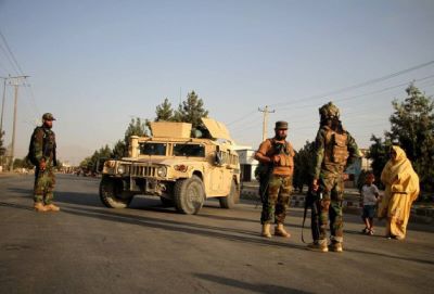
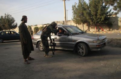
U.S. Central Command said on Sunday that U.S. military forces carried out an airstrike in Kabul against a suspected ISIS-K vehicle, which could pose an imminent threat to the airport.
The airstrike eliminated “an imminent ISIS-K threat to Hamad Karzai International airport,” U.S. Central Command Spokesman Bill Urban said in a statement, referring to a local affiliate of the Islamic State in Afghanistan.
ADVERTISEMENTx
“We are confident we successfully hit the target. Significant secondary explosions from the vehicle indicated the presence of a substantial amount of explosive material,” Urban said.
“We are assessing the possibilities of civilian casualties, though we have no indications at this time. We remain vigilant for potential future threats,” said the spokesman.
The airstrike came after U.S. President Joe Biden warned on Saturday that another terror attack against Kabul airport could be “highly likely in the next 24-36 hours.”
It was the second U.S. military strike in Afghanistan since a suicide bombing outside Kabul airport on Thursday killed 13 U.S. service members and some 170 Afghans. ISIS-K had claimed responsibility for the attack.
In retaliation for the deadly attack, the U.S. military on Friday launched a drone strike against the terror group in Nangarhar province of eastern Afghanistan, which killed two “high-profile” members and wounded another, according to the Pentagon.
The United States has been scrambling to evacuate Americans and its Afghan partners from the country since the Taliban entered Kabul on Aug. 15. The White House said on Saturday that around 111,900 people had left Afghanistan since Aug. 14.
Update: 6 Afghans killed after rocket falls into residential area in Kabul
A rocket struck a house in a populated residential area, west of the Hamid Karzai International Airport in Kabul, killing two adults and four children.
Six Afghan civilians, including four children, were killed after a rocket was fired at the Kabul airport where the U.S.-led evacuation flights were continuing but failed to hit the target, a local source confirmed.
ADVERTISEMENTx
“The rocket struck a house in Khwaja Bughra, a populated residential area in Police District 15, killing two adults and four children,” Hajji Karim, a representative of the neighborhood in the municipality district, told reporters at the site.
The incident occurred roughly at 4:55 p.m. local time in the area, west of the Hamid Karzai International Airport.
On Thursday, a deadly suicide bomb blast and gun firing claimed by ISIS-K, a local affiliate of the Islamic State group, killed 170 Afghans and 13 U.S. troops at an eastern gate of the Kabul airport and injured nearly 200 others.
No group has claimed responsibility for the attack. Taliban officials and public health authorities have not commented on the blast so far.
The attack came after a U.S. drone was hovering over the city, witnesses said.
Dozens of planes, including military planes, took off from the airport during the day. All U.S. and coalition forces are expected to leave the country on Aug. 31, a planned deadline.
How climate change helped make Hurricane Ida one of Louisiana worst
From its birth, the storm was destined to become a monster. It formed from air that was hot, moist and thick with clouds. It incubated in the sultry Gulf of Mexico, drawing power from water that was unusually warm.
By the time Hurricane Ida made landfall in Port Fourchon, La., on Sunday, it was the poster child for a climate change-driven disaster. The fast-growing, ferocious storm brought 150-mile-per-hour wind, torrential rain and several feet of storm surge to the most vulnerable part of the U.S. coast. It rivals the most powerful storm ever to strike the state.
“People there are going to get blasted,” said Kerry Emanuel, an atmospheric scientist at the Massachusetts Institute of Technology who studies the physics of hurricanes and their connection to the climate. “This is exactly the kind of thing we’re going to have to get used to as the planet warms.”
Hurricane Ida is the latest storm to batter the United States this summer. Tropical Storm Henri weakened as it inundated coastal communities in New England earlier this month, but it still knocked out power to more than 120,000 homes in three states and dumped a record 1.89 inches of rain on New York City in just one hour.
And hurricane season is far from over, as five other tropical systems are now sweeping over the Atlantic Ocean.
Scientists had been bracing for the worst since the moment forecasters identified a tropical depression forming last week. The Gulf of Mexico in August is always a hotbed of hurricane formation. “This time of year, it’s like bathtub water,” said Brian Tang, an atmospheric scientist at the University at Albany in New York.
Lately, conditions in the ocean have been exceptionally bad. According to the National Oceanic and Atmospheric Administration, parts of the Gulf are three to five degrees Fahrenheit higher than the average for the end of the 20th century. Research shows that human greenhouse gas emissions have caused the ocean to warm faster in recent years than at any point since the end of the last ice age.
All this warm water is to hurricanes what gasoline is to a car engine, Tang said. A powerful storm takes energy from the ocean and converts it into roiling clouds and roaring winds.
As Ida developed, it traveled over the hottest parts of the gulf, sucking up energy to fuel its rapid growth. With no shifting upper atmosphere winds to disrupt it, the ring of thunderstorms around the hurricane’s center – called the eyewall – started to churn faster and faster.
Even worse, the sea surface temperature rose as the hurricane got closer to the coast.
“That’s really like stepping on the accelerator,” Tang said. “Flooring it, basically.”
Barely 24 hours after it was identified as an unnamed tropical depression in the Caribbean on Thursday, its wind speeds reached 75 miles per hour – enough for the storm to be upgraded to a hurricane. By Saturday night, winds were hitting 105 miles per hour, making Ida a Category 2 storm.
Kimberly Wood, an atmospheric scientist at Mississippi State University, went to bed with a sinking feeling in her gut.
She woke Sunday to reports from the National Hurricane Center that peak winds were at 150 miles per hour. She thought of all the people who would not have time to evacuate in response to the sudden escalation.
She looked again at satellite images showing what scientists call a “well-organized” storm.
Wood wishes that the scientific terminology didn’t sound so much like a compliment. “It sounds like we’re cheering it on, but we’re not,” she said. “I feel sick to my stomach.”
Emanuel of MIT calls such rapid intensification a “canary in the mine” for climate change. Warmer conditions raise the “potential intensity” for storms – in other words, how bad they can get if nothing disrupts them. Climate change has also widened the disparity between the amount of heat in the ocean and the amount of moisture the atmosphere can hold, which accelerates the process of evaporation and energy transfer.
“Things happen faster,” he said. “It’s getting to a larger velocity and it’s taking less time to get there.”
In a 2017 paper published in the Bulletin of the American Meteorological Society, Emanuel found that once-in-a-century intensification events – in which wind speeds accelerate about 70 miles per hour in just 24 hours – could happen every five to 10 years by 2100. Human-caused warming could lead to never-before-seen escalation of hurricanes, causing unheard-of surge in wind speeds of 100 miles per hour or more.
Climate change not only sets the stage for bigger, fiercer, faster storms, it also makes the deadliest aspect of hurricanes – a deluge of water – even more intense.
For each degree Celsius that air heats up, it is able to hold 7 percent more moisture. This leads to exponentially heavier precipitation during storms.
Rainfall from Hurricane Harvey, which hit Houston in 2017, was made at least 15 percent worse by human-caused warming. Emanuel has found that events like it could become six times more frequent by the end of the century.
“It’s hard to say for any one thing, ‘Yes, for sure this is climate change,’ ” Wood said. “But the warmer waters and the amount of moisture in the air, this in general is going to increase as the climate warms.”
Torrential rain can worsen the effects of hurricanes even when the wind isn’t very strong. Wood noted that Hurricane Henri had deteriorated to a tropical storm by the time it made landfall in Rhode Island, but its torrential rain triggered widespread flooding.
In a small stroke of luck for residents of coastal Louisiana and Mississippi, Hurricane Ida is not expected to slow down significantly as it moves across the land – a behavior that made rainfall from Harvey and Henri especially extreme. But meteorologists still have forecast as much as 20 inches of rain for areas in Ida’s path.
Rising sea levels linked to global warming will also exacerbate the storm’s effect. Few places in the United States have suffered more from rising waters as Louisiana, where seas in some areas are 24 inches above their 1950 levels. This is partly because of development that has eroded the coastline and caused land to sink. But it is made worse by faraway melting glaciers, and the fact that ocean water expands as it warms.
The higher the baseline sea level, the more water will be pushed on shore by wind during hurricanes.
Wood urged residents not to underestimate the potential power of all this water. Just six inches of moving water can knock a healthy adult to the ground. Two feet is enough to float a car, sweeping away the vehicle and anyone inside it.
A 2014 study in the Bulletin of the American Meteorological Society found that 76 percent of fatalities from hurricanes between 1963 and 2012 were caused by storm surge or flooding.
“Those who are hunkering down on the coast are going to be pretty battered from this,” Wood said.
In an era when climate change has raised the bar for how bad hurricanes can become, Emanuel said, Hurricane Ida is a hint of what can happen when a storm reaches its “full potential.”
Energized by hot water, unobstructed by landforms or disruptive wind, Ida surged ashore Sunday with overwhelming force. Towering waves have ripped boats from their moorings and threatened to sweep people out to sea. Trees toppled and roofs went flying amid brutal blasts of wind.
With conditions too dangerous to attempt rescue operations, officials pleaded with people in flooded areas to stay in their homes and wait for the storm to pass.
This monster could not be battled or outrun. As night fell on Louisiana and Ida plowed inland, all people could do was endure.
Ida makes landfall as Category 4 near Port Fourchon, Louisiana
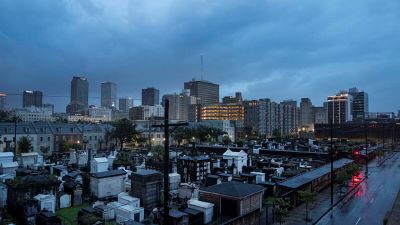
On the 16th anniversary of Hurricane Katrinas assault on New Orleans, Category 4 Ida slammed into the southeast Louisiana coastline after rapidly gaining strength Saturday night. The powerhouse storm, packing winds of 150 mph, is forecast to wallop New Orleans with hurricane-force winds and over a foot of rain Sunday afternoon and evening.
Near where Ida comes ashore, the National Hurricane Center is predicting “potentially catastrophic” wind damage and an “extremely life-threatening” ocean surge. Devastating effects from destructive winds and flooding rain could extend more than a hundred miles inland.
Hours before landfall, NOAA and Air Force Reserve Hurricane Hunter aircraft flew into Hurricane Ida, data helped the National Hurricane Center determine that Ida’s hurricane-force winds extended up to 50 miles from the center, with tropical-storm-force winds up to 150 miles away.
Ida made landfall at 12:55 p.m. and is moving northwest at about 13 mph. The hurricane is projected to turn north by Monday morning as it loses strength over land but produces extremely heavy rainfall.
ADVERTISEMENTx
Tracking by PowerOutage.us showed that nearly 315,000 customers in Louisiana had lost power, with about 100,000 losing service in just the past hour. The outages were concentrated in the southeastern part of the state, near where Ida made landfall.
Sustained winds of 40 mph, gusting to 59, have been reported at the Louis Armstrong New Orleans International Airport.
In the areas hit hardest by outages, a majority of customers were without power. Plaquemines Parish was worst, with the power out for nearly 85% of tracked customers, followed by Terrebonne Parish, where 76% were without power.
Grand Isle, La., located immediately to the east of where Ida’s eye came ashore, has been hammered by the storm’s most intense winds and an unforgiving ocean surge.
A Davis weather station clocked a wind gust of 146 mph; this is not an official reading but is plausible considering the intensity of the storm and Grand Isle’s location. The Grand Isle police chief told the Weather Channel he clocked a 148-mph gust.
A weather station at Southwest Pass, La., located in the most southeastern part of the state, recorded a gust of 128 mph earlier Sunday.
Anthony S. Fauci, the nation’s leading infectious-disease expert, said Sunday that he worried Hurricane Ida could worsen the already dire coronavirus situation in Southern states.
“You’re having two potential or real catastrophes conflating on each other,” Fauci said during an appearance on CNN’s “State of the Union.”
Fauci described the coronavirus situation in Louisiana as “bad enough,” though he said Gov. John Bel Edwards (D) was “doing a very good job in trying to keep things under control.”
Coronavirus infections, hospitalizations and deaths in Louisiana hit their highest levels of the pandemic this month, with the state becoming an epicenter amid the surge fueled by the delta variant. Average new daily cases are declining after exceeding 5,000 the week of Aug. 12, but they remain above 4,000, according to Washington Post tracking.
Hospitals remain strained, with a seven-day average of nearly 2,500 inpatients. Edwards told the Associated Press that officials would consider evacuating hospitals in affected areas under normal circumstances. But doing so “isn’t possible” with beds full of covid patients, he said, noting: “We don’t have any place to bring those patients.”
Fauci said the hurricane threatened to make a bad situation worse.
“We’re having a situation where, even when you’re stressed to the limit, to superimpose upon it what will likely be a historic weather, environmental catastrophe is going to do nothing but make things much, much worse,” he said.
In Gulfport, Mississippians woke up to tornado warnings in Hancock County and rain bands moving across the Gulf Coast on Sunday morning. Highway 90 was quickly inundated by a storm surge, and some neighborhoods are dealing with water in low-lying areas, but most are faring well as Hurricane Ida comes ashore in Louisiana.
Harrison County, which includes the cities of Biloxi and Gulfport, initiated a curfew at 8 a.m. Sunday until further notice. Hancock County’s curfew begins at 6 p.m. Sunday and ends at 6 a.m. Monday. Six shelters are open in Harrison County, including two that accept pets, and emergency personnel are in place should high-water rescues become necessary. About 150-200 people are in Harrison County shelters.
So far, things are going smoothly, Harrison County Fire Chief Pat Sullivan said Sunday afternoon. He credited the curfews, along with the closure of local casinos, with keeping people off the roads, but he cautioned that while all seems calm right now, flooding will remain a concern, even as the storm moves northward.
“The storm is not over yet,” Sullivan said. “We don’t know what the back side of this storm is going to bring, so we have to be prepared for the next phase. You can’t let your guard down. There may be river flooding and street flooding, so we don’t want people going out.”
Area residents are accustomed to storms and are generally prepared to take care of themselves and one another, he said.
“I tell people all the time that we have a PhD in storm prep because of Katrina,” Sullivan said. “Most of the people that live on the [Mississippi] coast know what to do and when to evacuate. A lot of times we don’t have to say anything to them, because they’re way ahead of us. They’re smart, they’ve been through this before. They know how to take care of themselves, and we take care of one another.”
New Orleans officials said Sunday that they are confident their levee system will not fail as it did in Hurricane Katrina, allowing water to surge into the city. Their main worry: torrential rains.
The area is projected to get 15 to 20 inches of rain from Saturday into Sunday, authorities said at a midday news conference held just before Hurricane Ida made landfall. The downpour could exceed three inches per hour, overwhelming the city’s drainage systems and causing flooding.
Leaders warned that the hurricane would cut people off from some city services. The police department is working at “100 percent,” Police Superintendent Shaun Ferguson said, but at some point, it would “have to hunker down.”
“Our health-care system, our hospitals are hunkering down,” echoed Jennifer Avegno, head of the New Orleans Health Department. “They are caring for the patients that are within their walls. Our first responders will be unable to get to you. Please do not try to access a health-care or a hospital facility right now. We will be there for you when the storm passes, but the safest thing you can do is to stay put.”
Authorities urged people to conserve water and said they should stay inside until told otherwise.
“You have everything that you need,” said New Orleans Mayor LaToya Cantrell (D). “We will get through this, together.”
Jefferson County Parish spokeswoman Gretchen Hirt Gendron said Sunday that the Grand Isle mayor believes about 40 people remained on the island town just off the coast of Louisiana and about 50 miles south of New Orleans. Some are residents; others are first responders staying in a fortified building so that they can respond as soon as it is safe, she said.
Surveillance footage from a parish council member captured tables and benches surrounded by water; other clips showed rushing rapids and trees flailing in the wind, also swamped.
Council member Scott Walker tweeted Sunday morning that the situation was “escalating quickly,” with gusts well over 100 mph. By midday, he shared news that a Grand Isle wind-measurement device “broke” at 148 miles per hour and said wind data had been “down for a while.”

 จีนเพิ่มความเข้มงวดการตรวจตราอุตสาหกรรมกองทุนมูลค่า 9.3 ล้านล้านดอลลาร์
 คณะนักโบราณคดีเชื่อกันว่าอาณาจักรสู่โบราณรุ่งโรจน์อยู่นานกว่า 2,000 ปี
 ผู้นำฟิลิปปินส์ยกเลิกคำสั่งห้ามเปิดบ่อน หวังฟื้นฟูเศรษฐกิจประเทศ
 นิวซีแลนด์แถลงพบผู้เสียชีวิตหลังฉีดวัคซีนโควิด-19 ของ Pfizer
 จีนชี้สหรัฐควรเคารพอธิปไตยอัฟกานิสถาน ร่วมมือตอลิบานสู้กลุ่มก่อการร้าย